



Safe & Secure Payment
Contact 24 Hours Day
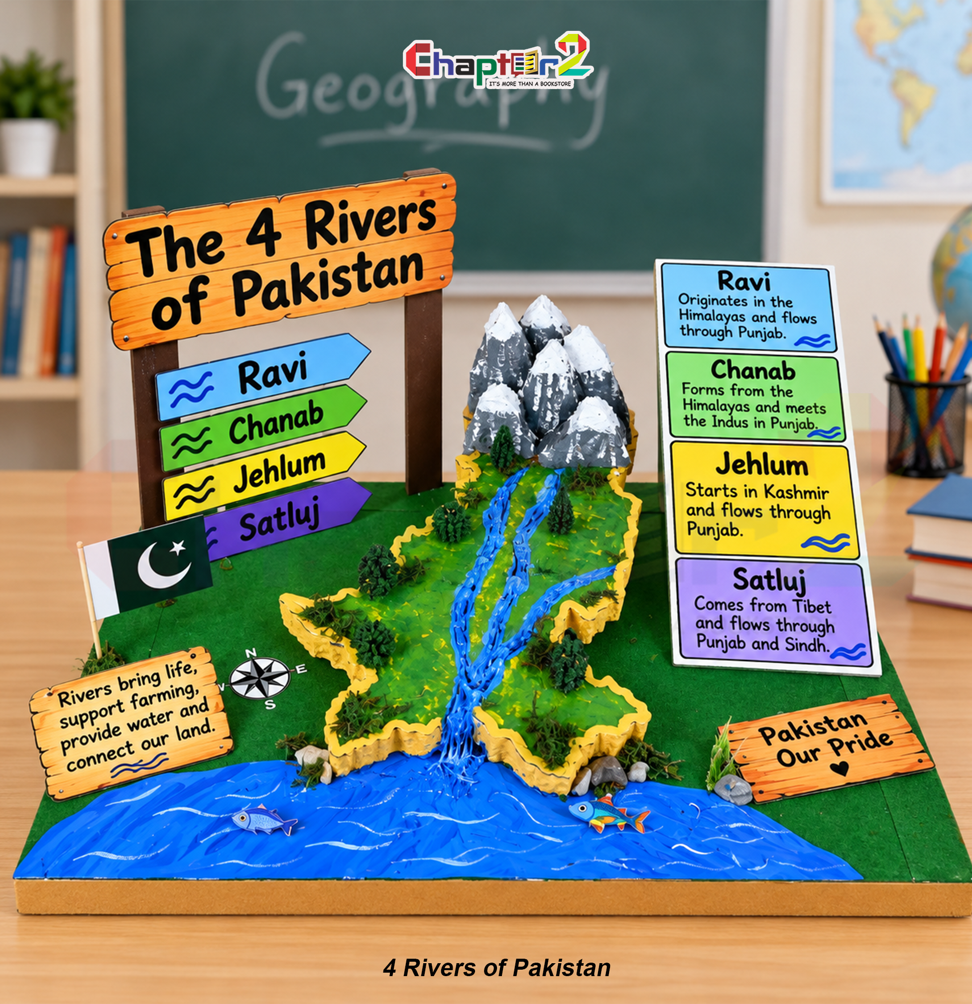
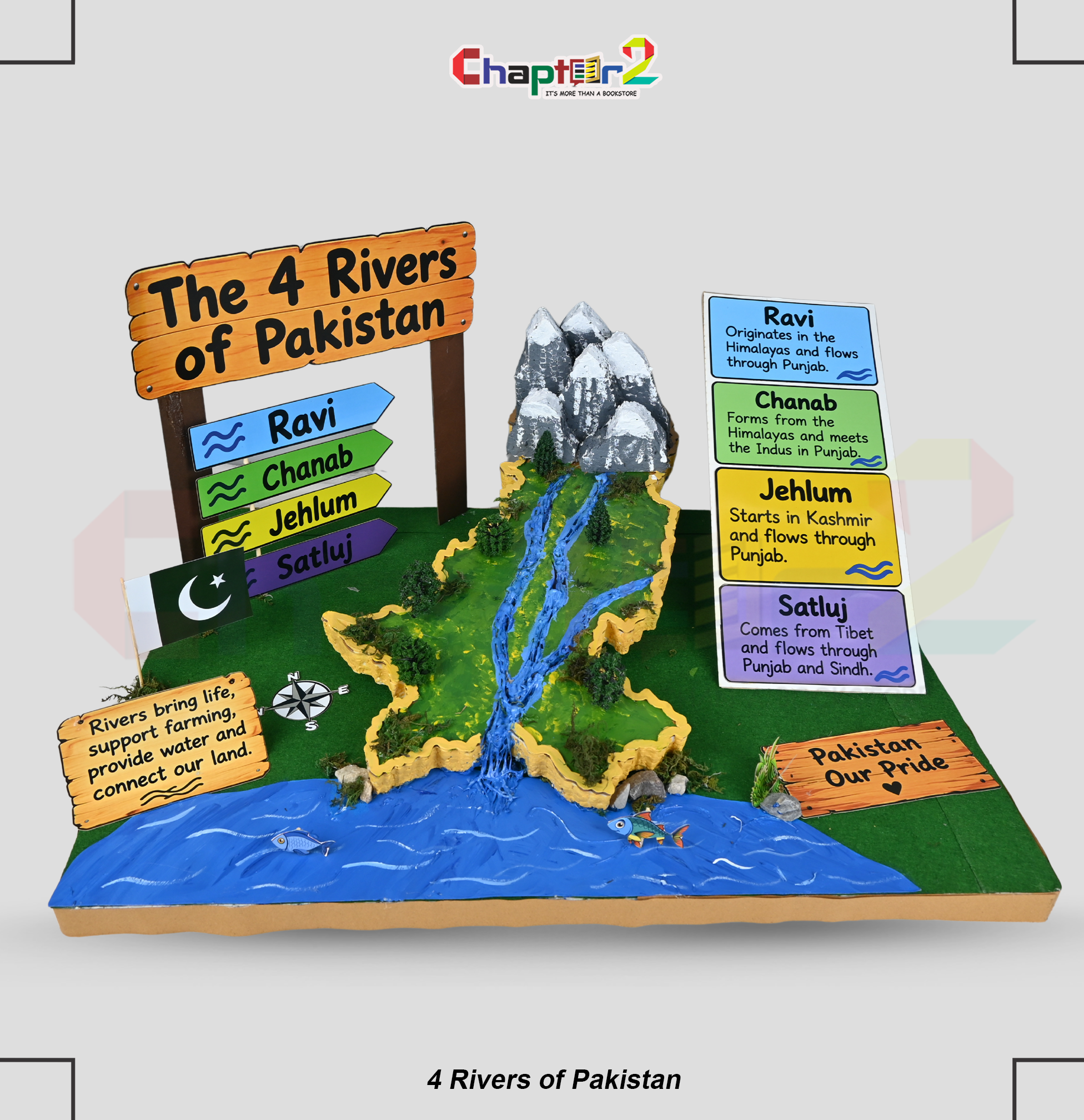
Perfect for school geography exhibitions and Pakistan Studies presentations, this handmade 3D student project 4 rivers of Pakistan model showcases the river networks of Ravi, Chanab, Jehlum, and Satluj originating from snow-capped mountains across a 3D relief map. Customer always customize his Child Project according to customer requirements.
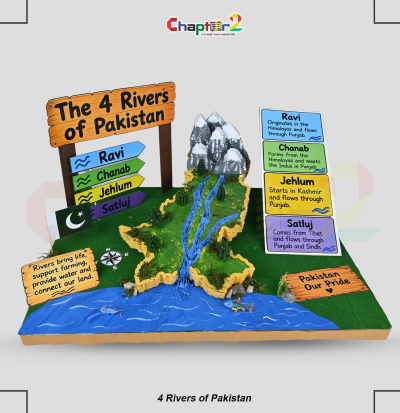
Bring Pakistan Studies, hydrology, and physical geography lessons to life with this ready-to-present 3D student project 4 rivers of Pakistan model. Specifically designed to fulfill primary, middle, and high school geography curriculum standards, this tabletop display illustrates the crucial water networks that sustain the nation’s agriculture, ecosystems, and economy. Whether presented at an annual school science fair, a social studies exhibition, or submitted for term homework grading, it provides an organized, high-scoring visual display.
Custom Geography & River Themes: Adapt the project to feature the complete Indus Basin irrigation system, major dams and barrages (such as Tarbela and Mangla), or river confluence points like Panjnad.
Personalized Student Details: Incorporate your child’s name, class grade, roll number, section, and school emblem directly onto a custom presentation plaque or side banner.
Tailored Dimensions & Stand Layouts: Adjust base board dimensions, mountain elevation heights, or map scales to comply with specific school exhibition table regulations and display booths.
Custom Explanatory Labels & Cards: Modify river fact cards, add length and origin details, or include bilingual educational pointers tailored to early-years, middle, or secondary grade curriculum levels.
Crafted with multi-layered tactile relief and informative signage to explain river origins and downstream flow:
Glacier Snow Peaks: Sculpted high-relief mountain ridges with snowy summits representing the Himalayan, Karakoram, and northern headwaters.
3D Relief Map of Punjab & Waterways: Elevated geographic landform detailed with miniature pine trees, textured moss, and blue river channels flowing down into a wide river basin.
Directional Signpost & Flag: Features a wooden-textured road sign with color-coded arrows pointing out “Ravi”, “Chanab”, “Jehlum”, and “Satluj”, accompanied by an upright National Flag of Pakistan.
Comprehensive River Information Board: Includes color-matched summary cards detailing origin and path facts:
Ravi: Originates in the Himalayas and flows through Punjab.
Chanab: Forms from the Himalayas and meets the Indus in Punjab.
Jehlum: Starts in Kashmir and flows through Punjab.
Satluj: Comes from Tibet and flows through Punjab and Sindh.
Inspiring Educational Plaques: Finished with wooden-style motto signs reading “The 4 Rivers of Pakistan”, “Rivers bring life, support farming, provide water and connect our land”, and “Pakistan Our Pride” alongside a navigational compass rose.
Buy 3D Student Project 4 Rivers of Pakistan Geography Model
Reviews
There are no reviews yet.